Travel
·
Story
Southland / Fiordland
Three Days on the Hump Ridge: The New Zealand You Have to Walk Into
Three days, endless stairs, ancient forest and a sunrise over Fiordland. Some parts of New Zealand only make sense once you walk into them.
Cesar Carvajal

Cass was the one who wanted to do the Hump Ridge. We have a frame at home with New Zealand’s Great Walks on it, so I knew the name and recognised the strange outline of the track - to me it looked a little like a large hut with a very long brim - but I honestly did not know much more about it. She asked if she could book it, I said yes, and several weeks before the walk we paid for three days on a track I had barely researched. I wasn’t worried; actually, I was excited. Three days walking somewhere new in New Zealand sounded exactly like the sort of thing I wanted to do, although I did throw my poles into the car because three days on your feet can become a completely different experience if a knee or ankle suddenly decides not to cooperate.
We drove from Queenstown to Tuatapere, checked in at the Hump Ridge office and then continued towards Rarakau, where the walk begins. Today the Tuatapere Hump Ridge is New Zealand’s eleventh Great Walk, a roughly 60-kilometre loop through beaches, native forest, subalpine terrain and a landscape carrying layers of Māori, industrial and community history. It only officially became a Great Walk in October 2024, although the track itself opened more than twenty years earlier and people had been travelling through this country long before a modern tramping route existed.
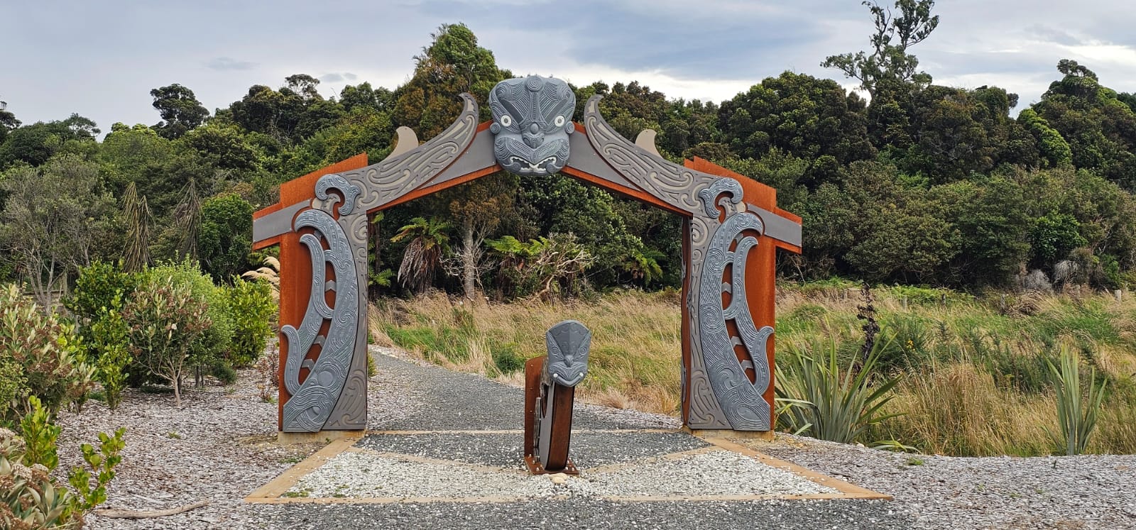
The waharoa near the beginning of the Hump Ridge journey. The modern Great Walk crosses a landscape shaped by mana whenua, private landowners, conservation and generations of local community effort.
I knew very little of that when we started. On the first morning, what mattered was that everything felt new: the coast, the bush, the sound of the water, our backpacks and the simple excitement of knowing that for the next three days life had been reduced to walking, eating, drinking, looking around and eventually finding somewhere to sleep. It is one of the things I enjoy about hiking. Most of the ordinary complications of life temporarily disappear because the body gives you a much shorter list of priorities.
Then the Hump Ridge starts going up.
Climbing towards the sky
The first day leads from Rarakau around the coast and then turns inland before climbing through coastal forest and mountain beech towards Ōkaka Lodge, above the tree line. DOC rates the track as demanding enough to require moderate to high fitness, with days that can mean seven to nine hours of walking and significant elevation gain. For the first few hours I was amazed by the landscape and simply happy to be somewhere I had never seen before, but as the climb continued the walk slowly became something more internal.
There seemed to be an infinite number of stairs. After a while, I stopped thinking about how far we had left and started negotiating with myself one step at a time. I remember telling myself to keep moving, to be stoic, not to give up and simply step up once more. When your body becomes properly tired, your philosophy of life can become wonderfully uncomplicated: put this foot there, then move the other one.
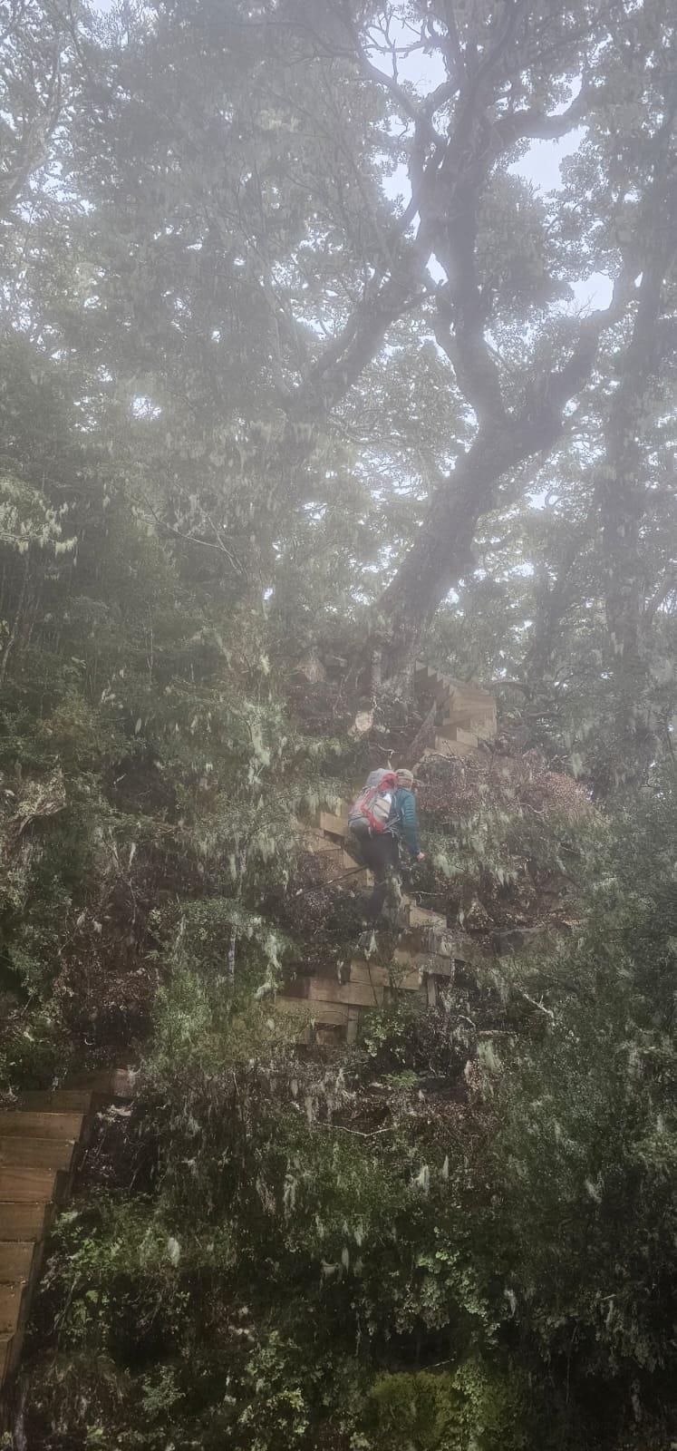
The climb towards Ōkaka passes through dense native forest before eventually rising above the tree line.
Near the top, fog arrived and then rain. By that point I was hot and tired enough that I did not feel like covering myself immediately, so I stayed in my T-shirt for a while and let the cold water hit my face and arms. It was exactly what I needed. After hours of climbing, the rain did not feel like bad weather; it felt refreshing, as though the landscape had decided to cool us down for the final part of the ascent.
We reached Ōkaka Lodge before sunset, took off our packs and enjoyed one of those little luxuries that becomes enormous after a long walking day: a five-minute hot shower. I finished mine with some cold water, then we ate, played games and relaxed with the satisfaction of knowing that the hardest part of the first day was behind us. At that point I thought the reward had already arrived.
The following morning proved me wrong.
The prize in the morning
Sunrise from the ridge was the real prize for getting up there. The horizon slowly began to glow, then the light opened across southern Fiordland and the ocean below us. On a clear day the views stretch across Te Waewae Bay towards Rakiura, and standing there early in the morning you suddenly understand how high the previous day’s stairs have taken you.
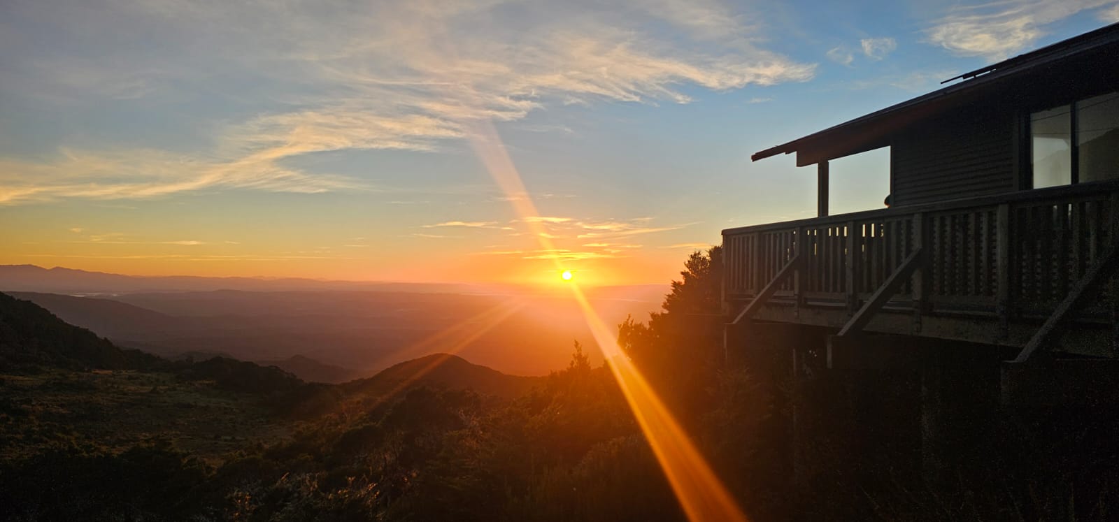
Morning on the Hump Ridge. After the first day’s climb, the track opens above the forest with views across southern Fiordland and towards Rakiura.
After breakfast we went for the short walk around the ridge above the lodge, where the landscape changes again. Large sandstone tors rise from tussock and small alpine tarns collect between them. The geology of the ridge has weathered into extraordinary rock towers, and the boardwalk moves through a place that feels almost detached from the country below.
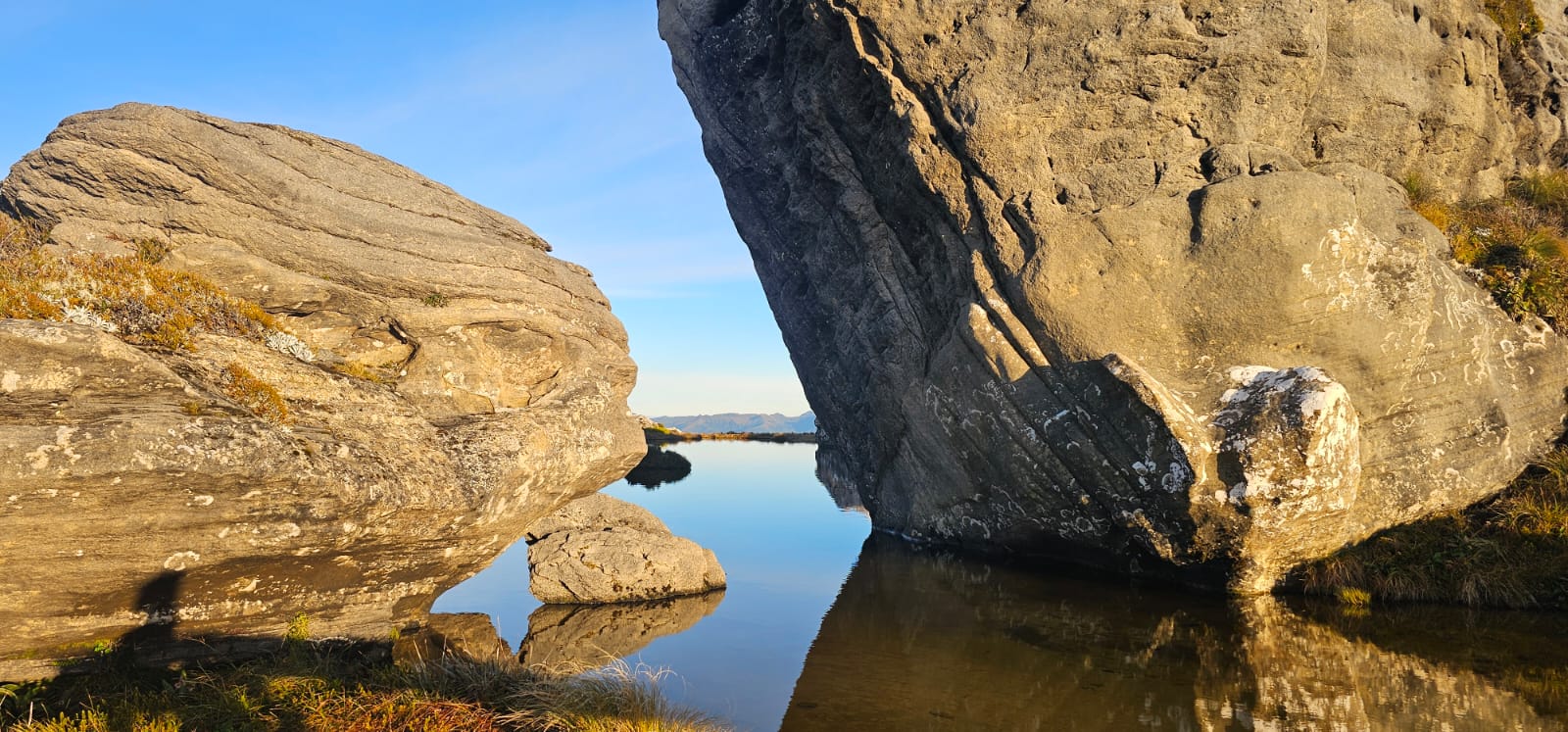
Sandstone tors and alpine tarns above Ōkaka. For a while, the Hump Ridge feels like another dimension.
That morning I found myself feeling enormously fortunate. There are beautiful landscapes, and then there are landscapes that temporarily change your sense of scale. Standing among those huge rocks and still pools, above the forest and with the ocean stretched out in the distance, I felt that particular mixture of awe and gratitude that is difficult to manufacture deliberately. Sublime is an old word, but sometimes it is still the right one.
This track existed before it became a Great Walk
Looking at a place like this, it can be tempting to imagine it only as wilderness, but the human history of the Hump Ridge is much older than the modern trail. When the upgrade to Great Walk status formally began, Ōraka Aparima Rūnaka held a Whakatau Te Whenua to acknowledge the whenua and the generations of tūpuna who had travelled through these lands and waterways, lived here and gathered mahika kai from the mountains to the sea. At the ceremony, Ōraka Aparima Hakui Muriel Johnstone also described an ancient aranui that travelled over the long ridge of Ōkaka and onwards towards the lakes and mountains of Fiordland.
That changed how I thought about the word track. We tend to imagine a trail beginning when somebody builds a boardwalk, draws it on a map and places markers along the route, but people were moving through this country generations before any of that existed.
The Great Walk itself also does not sit neatly within one ownership boundary. The route begins on Rowallan Alton land and includes conservation land as well as privately owned Māori land; the Great Walk project has required collaboration between DOC, Ōraka Aparima Rūnaka, the Hump Ridge Track Charitable Trust, Rowallan Alton Inc, SILNA landowners, Southland District Council, the Port Craig Viaduct Charitable Trust and others. It is one continuous journey for a walker, but beneath your feet are different histories, responsibilities and relationships with the land.
A track built by a town
The second day begins by giving back much of the altitude you worked so hard to gain. I was very happy to have packed my poles. The stairs heading down seemed closely related to those we had climbed the day before, and using the poles made the terrain easier on my legs and gave me more confidence when the descent became steep.
As I walked, however, I became increasingly aware of something I had barely considered before arriving: somebody had to build all of this. The steps, boardwalks and structures do not appear naturally in remote forest, and once you have spent hours walking through difficult terrain, the amount of labour behind a good track becomes impossible to ignore.
The Hump Ridge exists largely because the community of Tuatapere decided to create it. The idea was raised at a Tuatapere Promotions meeting in 1988, during a period when the local timber economy was declining. A charitable trust was formed, more than $3 million was raised, permissions had to be negotiated with government and private landowners, and the track eventually opened in November 2001. Around 25,000 community volunteer hours went into the original construction, including locals spending evenings for about a year assembling three-metre lengths of boardwalk in a woolshed before the material was taken into the track.
That story impressed me perhaps as much as some of the engineering itself. People from a small Southland town gave evenings and weekends to building boardwalk, while others raised money, negotiated access, transported materials, worked on maintenance and kept returning when the weather and the landscape inevitably damaged something. DOC says that over the decades the wider community contribution has exceeded 170,000 volunteer hours when maintenance, pest control and other work are included.
Walking down that second day, I kept thinking about people I will probably never meet and feeling grateful that they had chosen to give their time so that people like Cass and me could experience this place years later.
The forest begins telling another story
As the track descends, the alpine landscape gradually disappears and the forest closes around you again. Eventually the route reconnects with the South Coast Track and with the physical remains of another chapter of Southland history: the old Port Craig railway and sawmilling settlement.
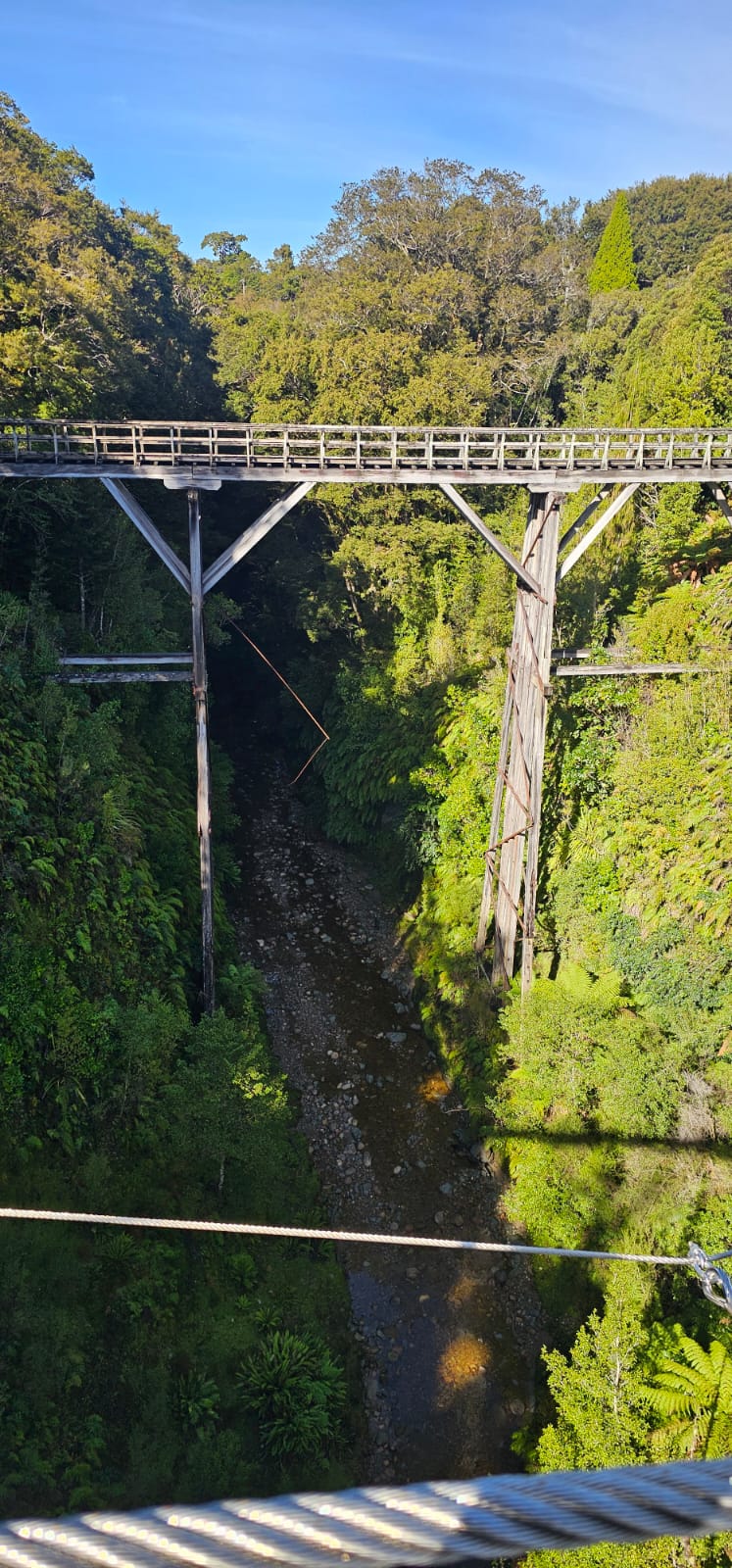
The old Port Craig tramway and its wooden viaducts are reminders of the industrial history hidden inside the forest.
Port Craig was once the site of one of New Zealand’s most advanced and productive sawmilling operations. The Marlborough Timber Company recognised the potential of the coastal forests in 1916, and at its peak more than 150 men worked around a settlement that included a school, blacksmith, wharf, cookshop, bakehouse, workers’ accommodation and a large modern mill. DOC records that around 1,400 hectares of forest were logged and that the operation could process up to about 1,800 cubic metres of timber in a month.
Moving all of that timber required serious infrastructure. A 14.6-kilometre tramway ran through the forest and four large wooden viaducts carried the line across deep ravines. When you encounter them after hours surrounded by forest, there is something almost surreal about seeing that level of engineering hidden among the trees. They are impressive structures, but they also make the scale of the old industry visible in a way that a paragraph in a history book cannot.
There is another layer to that story. DOC records that the mill, needing access to more timber than could be obtained from its State Forest allocations, also logged Māori-owned land granted under the South Island Landless Natives Act 1906, with the agreement of the owners. The wider history of SILNA is complicated and painful. The legislation was supposed to provide an economic base to Kāi Tahu people who had become effectively landless following large Crown land purchases, but Te Rūnanga o Ngāi Tahu explains that much of the land allocated was remote, economically poor and difficult to develop; the Waitangi Tribunal later described the scheme as a “cruel hoax”.
I do not think a travel story can tell that full history, and I would not pretend that mine does. But I think it matters to acknowledge it. Walking through the Hump Ridge means moving through a landscape where conservation, Māori relationships with whenua, industrial extraction, private ownership and community recreation all exist in the same place. The forest looks timeless, but the history underneath it is anything but simple.
Port Craig and the sandflies
The Port Craig sawmill eventually closed in 1928 as timber demand declined and the operation became uneconomic. The settlement largely disappeared, but traces remain: old wharf piles, machinery, a baker’s oven, railway sleepers and the archaeological footprint of the mill. The old school building survived and became a backcountry hut.
By the time we reached our lodge that afternoon, though, my interest in industrial history was competing with much more immediate priorities. My legs wanted to stop, and the beach was nearby, so Cass and I decided that a swim in cold Southland water sounded like a sensible recovery strategy. The beach was quiet, beautiful and almost perfect, except that the sandflies had apparently received advance notice of our arrival and were waiting in impressive numbers.
I like that detail because New Zealand has a way of preventing its wilderness experiences from becoming too romantic.
Walking back towards the sea
The third day felt completely different. The hard climbing and descending were behind us and much of the route became flatter as we followed the coast back towards Rarakau. After two days of seeing the sea from above or passing through forest, walking beside it again completed the geography of the journey. Places that had looked tiny from the ridge became enormous once we returned to sea level.
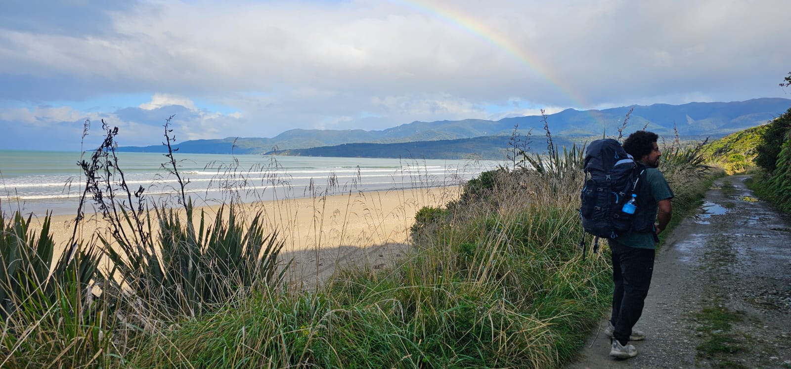
Back on the coast during the final stage of the walk, where the mountains slowly give way to beaches and Te Waewae Bay.
That is one of the things multi-day walking does particularly well. We drive enormous distances around New Zealand and can move through completely different landscapes in a few hours, but driving compresses almost everything between departure and destination. Walking does the opposite. It expands distance. A forest is no longer a green blur beside the road because you have spent hours inside it; a mountain is no longer part of the view because your legs now understand exactly how much terrain separates its bottom from its top. A beach has weather, a river has sound, wet bush has a smell and an old railway sleeper becomes interesting because you have had enough time to wonder why it is there.
Walking is one of the slowest ways to travel, which may be why it allows us to see so much.
The New Zealand you have to walk into
When I remember the Hump Ridge now, the first images are still the obvious ones: sunrise above the ridge, Rakiura sitting in the distance, enormous rock formations reflected in the tarns, the rain cooling my arms near the end of the climb, Cass walking ahead of me, the relief of using my poles on the descent and the beach waiting near Port Craig.
But the longer the walk sits in my memory, the more I think about people too. I think about tūpuna moving through Ōkaka long before it became a Great Walk, Māori landowners whose whenua remains part of this landscape, the people who worked the timber industry and built an extraordinary railway system through the forest, the families who lived at Port Craig and the Tuatapere community that watched one economic era decline and then spent years creating a different relationship between the town and the landscape around it.
I think about people assembling boardwalk in a woolshed at night, volunteers maintaining the track, conservation workers, mana whenua, private landowners and everyone involved in allowing the route to exist today. The Hump Ridge is beautiful enough that it would be easy to tell the story only through the views, but I came away respecting something deeper: the land, the histories inside it and the enormous amount of human effort required to give us access without pretending that the landscape began when we arrived.
I went because Cass asked me if she could book the walk, and I said yes without really knowing what I was saying yes to. I expected three days of hiking and some beautiful scenery, and I got both, but somewhere between the first beach and the final one the walk became something else.
To the people who made that journey possible, past and present, thank you.
The views were worth every stair, but the Hump Ridge gave me something more interesting than a beautiful view: it made me pay attention to what was underneath my feet.
Duration: 3 days / 2 nights
Distance: Around 60 km
Start and finish: Rarakau car park, near Tuatapere
Difficulty: Moderate to high fitness; expect long 7–9 hour walking days
Accommodation: Ōkaka Lodge and Port Craig Lodge
Bookings: Through the Tuatapere Hump Ridge Track Charitable Trust rather than the standard DOC Great Walk booking system.
Current 2026 note: The track is closed for winter. The Trust lists the next summer season as 23 October 2026 to 17 April 2027.
Viaduct update: Percy Burn and Edwin Burn viaducts are currently closed to crossings because of structural deterioration, but the Hump Ridge remains open using bypass routes; a swing bridge provides the Edwin Burn alternative.
Sources:
Department of Conservation - Tuatapere Hump Ridge Track
DOC - Port Craig sawmill and settlement history
DOC - Hump Ridge Great Walk upgrade / Ōraka Aparima Rūnaka context
Tuatapere Hump Ridge Track Charitable Trust - track history
Te Rūnanga o Ngāi Tahu - SILNA history
La conversación continúa
Esta historia no termina aquí.
¿Algo de esta historia se quedó contigo? Únete a la conversación, conoce a quien la escribió o ayúdanos a hacer posible la próxima.
Únete a la conversación en Facebook

Cesar Carvajal
Cesar Carvajal is a Colombian-born writer and editor based in Queenstown. He writes about travel, migration, culture and the experiences that slowly turn a place into home.
Invita un café al equipo
Etiqueta a Zealanding en Instagram
Keep Zealanding
A NOTE FROM THE EDITORS
Send Zealanding a local story lead, contact, photograph, idea or tip. The best stories often begin with a quiet nudge.